
TRAIL Report:
4/28/2021
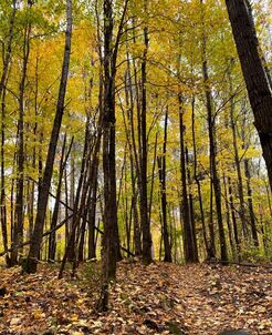
Happy Spring!! The CAMBA Trails at Ashwabay are open! Enjoy the scenic views and incredible trails, and don't forget to come back and visit us in the winter for cross country skiing and winter fat biking!
Happy Spring!! The CAMBA Trails at Ashwabay are open! Enjoy the scenic views and incredible trails, and don't forget to come back and visit us in the winter for cross country skiing and winter fat biking!
Hike our Nordic Ski Trails or the CAMBA Mountain Bike Trails
|
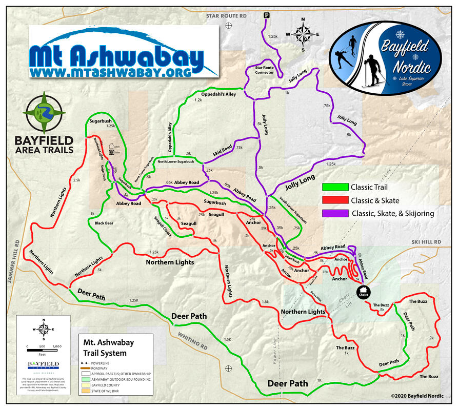
Hiking Trails
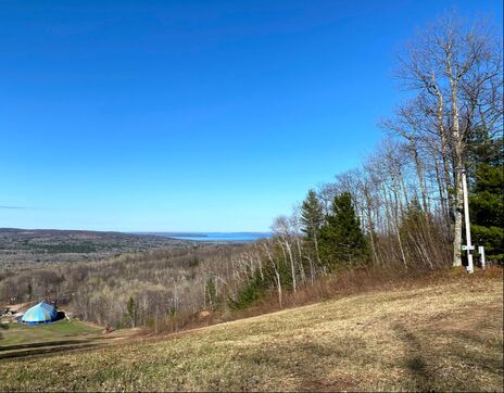
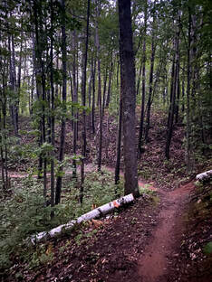
Hiking at Mt. Ashwabay include trails surrounding the main building at the top of Ski Hill Rd. There is a mixture of County Forest, State Natural Area and State Forest. These trails include a mixture of the CAMBA Mountain Bike Trails, Mt. Ashwabay Nordic Ski Trails & MT. Ashwabay Fat Bike Trails. Please note that some trails go through the Nourse Sugarbush State Natural Area and do not permit bicycles. Trail Features Wide grassy trails that function as cross-country ski trails in the winter and world-class single track mountain bike trails (which are pretty fun to experience also by foot)!! Trail Maps
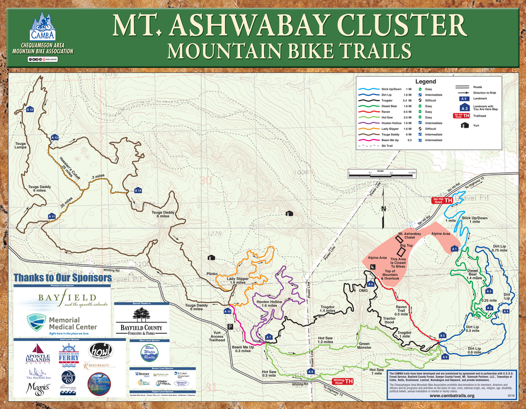
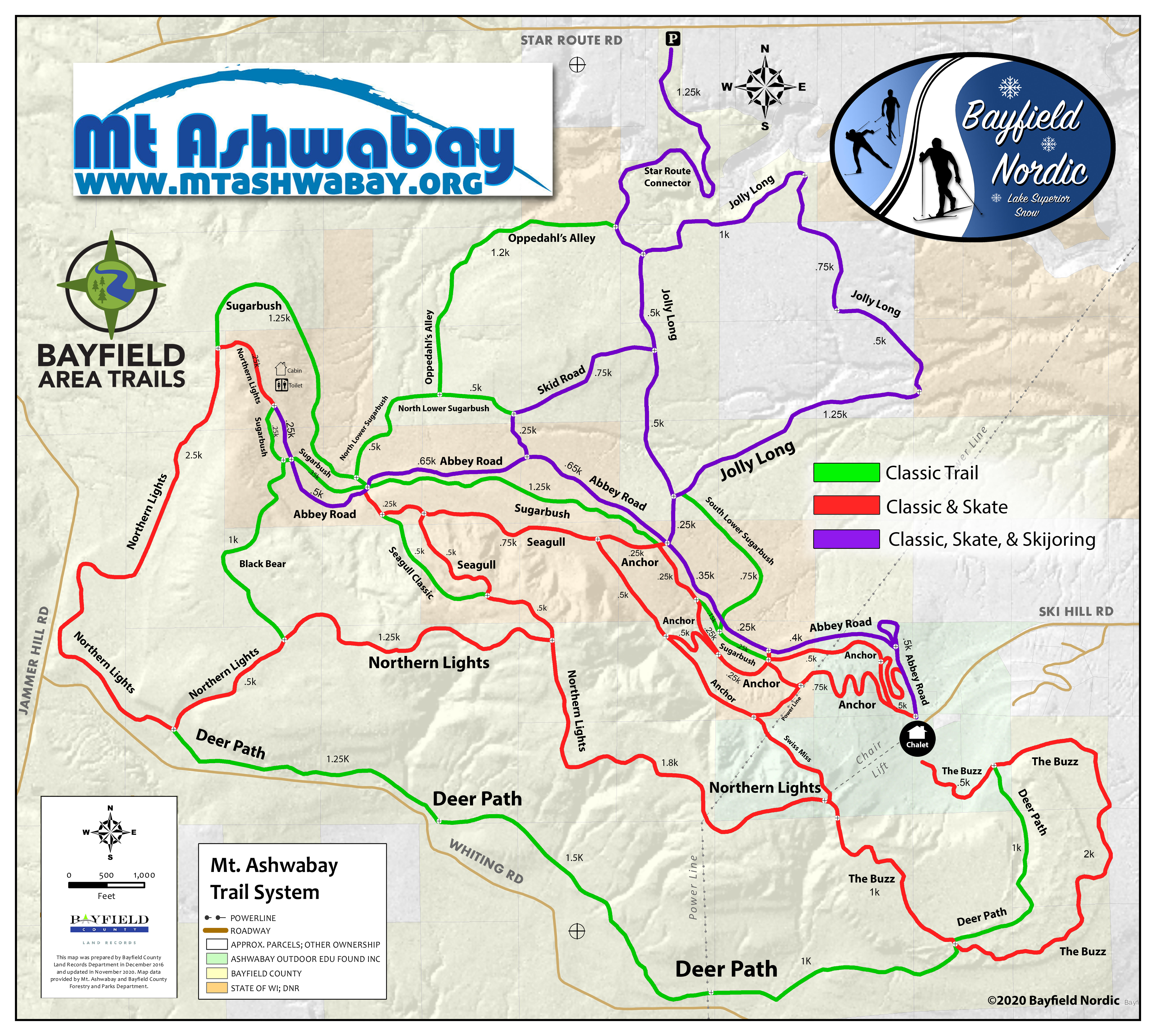
Click map to view larger image. Download a PDF of CAMBA Mt. Ashwabay Trail Cluster map HERE
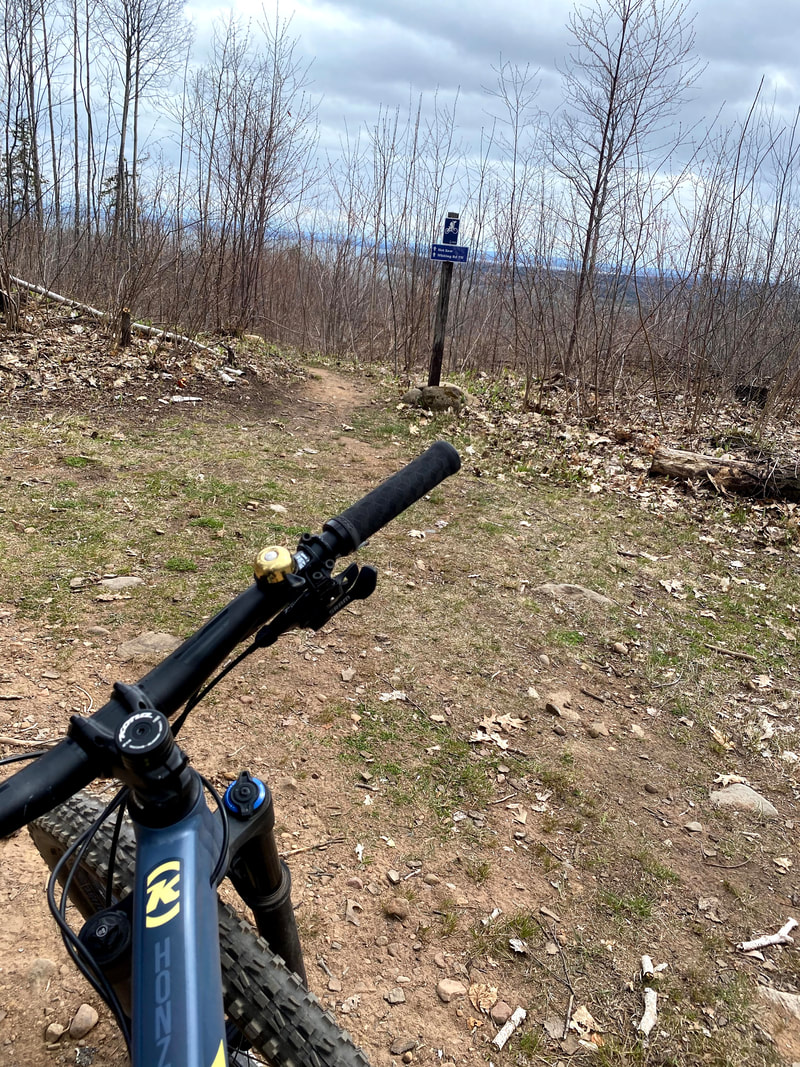
What to Expect: The main CAMBA mountain bike trailhead is on the South (left hand side) of the road BEFORE the main gate, directly across from Sugarbush Road. There is a secondary trailhead located of off Whiting Rd., near the powerline with accesses to the Hot Saw trail. You can access the other hiking trails by parking near the lodge.
Hiking and Biking is permitted only on trails designated with a Blue CAMBA Singletrack trail marker. We are working to develop quality mountain bike trails, and it’s important that all riders respect closures, whether temporary, or permanent. State law prohibits biking in the Nourse Sugarbush State Natural Area, adjacent to the Mt. Ashwabay property. Mt Ashwabay's Trail system is designed, built, and maintained by Volunteers. We use donated equipment and Volunteer labor whenever possible. If you have earth-moving equipment, excavating equipment, or a tractor and would like to volunteer or donate usage, please let us know. To contact Ashwabay about Volunteering or Donating, please click HERE |
| ||||
CAMBA Trail Descriptions at Mt Ashwabay
STICK UP-DOWN
Mileage: 1 mile Difficulty: Easy Trail Type: 100% singletrack Quickest Access: Ski Hill Rd. Description: Two-way trail to access and exit the trail system. Gradually climbs and descends with bermed switchbacks. Optional rock features add challenges for skilled riders.
DIESEL BEAR
Mileage: 1.4 mile loop Difficulty: Easy Trail Type: 100% singletrack Description: Serpentine, short climbs, rolling singletrack through a mixed forest of mature oaks, maples, and hemlocks. Quickest Access: Ski Hill Rd.
DIRT LIP
Mileage: 1.7 mile loop Difficulty: Intermediate Trail Type: 100% singletrack Description: Challenging bench cut trail with quick downs running into quick ups. This roller coaster of a trail will present opportunities to lift your tires, g-out in turns and challenge your skills on rock features. Dirt Lip can easily be connected with Diesel Bear for 3.3 mile figure-8 loop. Quickest Access: Either Ski Hill Rd. or Whiting Rd. Trailheads.
HOT SAW
Mileage: 2.5 mile loop Difficulty: Easy Trail Type: 100% singletrack Description: Wide, meandering, flowy trail slowly, climbing out of the Whiting Rd. Trailhead to reward the rider’s hard work with an expansive view over Chequamegon Bay. Return on a flowing gentle decent that will put a smile on your face erasing any memory of the challenge of the Green Monster. Quickest Access: Whiting Rd. Trailhead.
MAGIC CARPET (NEW!)
Mileage: .3 miles Difficulty: Easy Description: Take a ride on the easy rated Magic Carpet to connect the Ashwabay Cluster's more beginner-friendly trails, Diesel Bear and Hot Saw. Keep your eyes open for optional fun features for all types of riders.
TROGDOR
Mileage: 2.4 mile point-to-point Difficulty: Difficult Trail Type: 100% singletrack Description: Chunky-flow-style xc trail with punchy ups and fun downs that physically test riders. Trail concludes with a rapid descent through chicane turns to pump your adrenaline. Riders of varying ability will be rewarded with expansive views of Lake Superior and the Apostle Islands at the summit of Mt. Ashwabay. Can be cut a little shorter at the Mt. Ashwabay Summit by taking the Raven ski trail back to the start. Trogdor can also be looped with part of Hot Saw for a 3.6 mile loop. Quickest Access: Either Ski Hill Rd. or Whiting Rd.
HOOTEN HOLLOW
Mileage: 1.6 mile loop Difficulty: Intermediate Trail Type: 100% singletrack Description: Switch-backing climb to warm you up for the fun serpentine traverse of the Ashwabay ridge. Circle a large drainage to set up for a ripping downhill with a mix of intermediate rock gardens and lips that will leave you hooting at the bottom. Quickest Access: Whiting Rd Trailhead.
BEAM ME UP
Mileage: 0.3 mile two-way trail Difficulty: Intermediate Trail Type: 100% singletrack Description: As the name implies, get beamed up to Lady Slipper and Tsuga Daddy.
LADY SLIPPER
Mileage: 1.6 mile loop Difficulty: Expert/Advanced Trail Type: 100% singletrack Description: This trail has a split personality. It will test the climber in you with tight switchbacks and uphill rock gardens. Try not to dab; it is possible to clean. The other half will reward the descender with lips to grab some air, rock gardens to charge, and optional lines to huck. The Lady Slipper will tempt you but watch out… Quickest Access: Whiting Rd.
TSUGA DADDY
Mileage: 6 mile loop with cutoffs Difficulty: Intermediate Trail Type: 100% singletrack Description: The longest loop in the cluster with sinuous climbing and descending as it meanders and curls its way through multiple forest types in various stages of regeneration. Along the trail watch out for features to test your skills and the occasional Sasquatch. Quickest Access: Whiting Rd. Trailhead
|
All Trail info is from the official CAMBA Trail Guide... download it for yourself if you'd like more information about all of the Mountain Biking in CAMBA Country!
|
|